Tenaya
March
2012
Part Six
Stewart Island:
North Arm, Port Pegasus
Ben's Bay
| |
| HOME |
| About Tenaya |
| About Us |
| Latest Update |
| Logs from Current Year |
| Logs from Previous Years |
| Katie's View |
| Route Map |
| Links |
| Contact Us |
![]()
March 18, 2012
Ben's Bay: 47 10'.84S 167 39'.85E
The guidebook says this is an all-weather anchorage in shallow water, over a sand bottom, and good to head to if there are gale or storm warnings. As there was indeed a gale warning the day we moved up to the North Arm of Port Pegasus, we anchored here in Ben's Bay, aka Spar Cove.
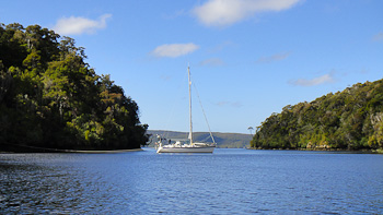
And once again we dropped and set the hook before I climbed down into the kayak and paddled over to secure two sternlines to sturdy trees. It's a snug place and very protected from the wind howling through the trees on the surrounding hilltops. You can see our spot at the lower left of the chartplotter picture at the yellow arrow.

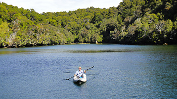
Between blasts of wind and drizzling skies we had marvelous warm sunshine so spent a lazy day kayaking and reading in the cockpit. There are a few sandflies here and lots of curious big bumble bees that are ever so intrigued by our brightly colored clothes pins and anything in the cockpit.
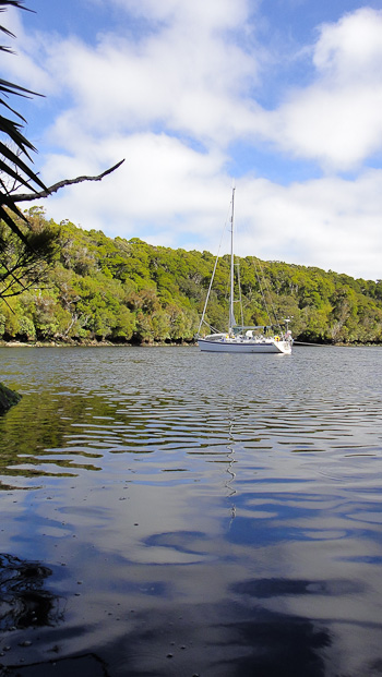
In the last few days we have seen the same large fishing boat several times, a smaller open boat and Southern Winds, the DOC boat, who are conducting sea lion research. That's it. Today when we dinghied to the other end of the arm we saw no boats.
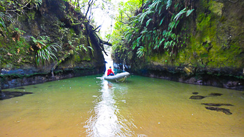
There is a tiny cove not far from the anchorage that, if you were not searching for it, would surely miss. The entrance is pictured below.
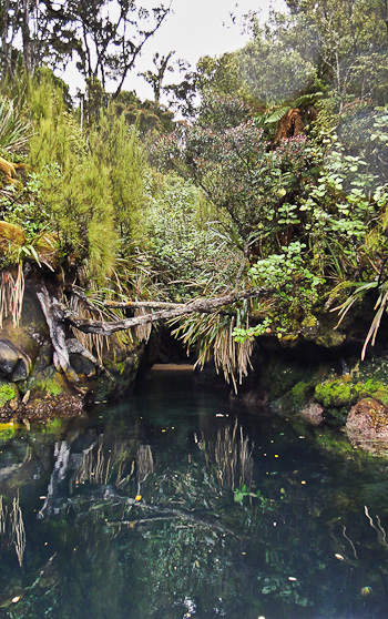
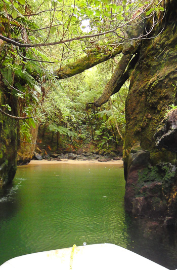
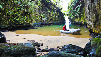
A narrow opening between two rock walls is just wide enough for a dinghy to squeeze through. It's plenty deep but we pushed ourselves along the wall with our hands to reach Smuggler's Cove.
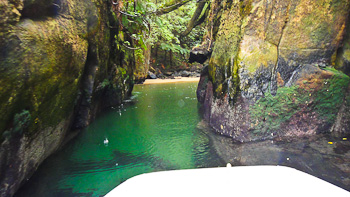
The tapered entrance widens into a secluded cove of emerald water with a sandy bottom and shore. Dark rocks are scattered about while ferns and other foliage dripping with moisture cling to the steep walls and form a canopy of green. It's an enchanting little wonderland.
The upper reaches of North Arm were settled a few different times for various reasons. A wharf, station and freezer were built on the west side of the arm in 1897 because of the fishing potential in the area and demand at Invercargill. Initially enough fish came from Port Pegasus to fill the freezer but eventually the fishermen went offshore. The station and freezer closed in 1914 but re-opened the following year and operated profitably into the 1930s.
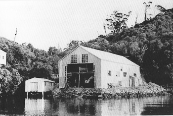
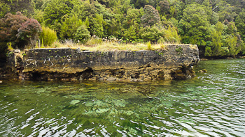
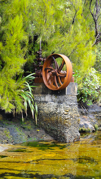
Sadly, all that remains of the fishing and freezing operations on the west side are the ruins of the wharf and the large Pelton wheel from the old compressor used for the freezer. The bush has steadily reclaimed the land.
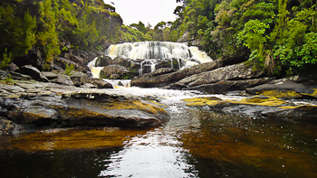
Belltopper Falls are at the head of North Arm where Pegasus Creek cascades into the harbour. The name comes from an incident involving an Invercargill businessman. He was on a sightseeing trip to the Tin Range in 1889 and, as was usual for the times, formally dressed. He wore a tall belltopper hat which caught in the branches of a tree and was almost lost. The name stuck.
Cassiterite, the primary ore of tin, was found across Diprose Bay, on the east side of the North Arm, during 1889. Within two months 70 mining licenses had been issued and another settlement emerged. A store, hotel and post office were built but very little ore was found in the Tin Range. Only a few claims were worked and by the end of 1890 the post office had closed.
It was worked again between 1912-1917 when a tramway about seven kilometers long was built across the southern end of the range. Apparently there is a hike to see relics of this operation, but because of our lack of success finding a supposedly simple track in South Arm, we had no desire to pursue this more difficult one.
Go to March 2012 Part Seven - Oban, Stewart Island
Read about our visit to Stewart Island last year